
When GPS Goes Silent, the Earth Does Not
Introducing HCNS: a patent-pending navigation architecture exploring GPS resilience, independent integrity monitoring, and natural environmental signals.
Developer of two technologies that received Awardable designations through the U.S. Department of Defense’s Tradewinds Solutions Marketplace.
On November 4, 2026, I filed my U.S. non-provisional patent application. Today, I am introducing another part of the work I have been building: the Harmonic Coherence Navigation System, or HCNS.
Its ambition is substantial: help machines recognize when their navigation inputs have become unreliable, and investigate whether natural environmental signals can provide another way to navigate when GPS is unavailable.
A potential backup for GPS, coupled with a system designed to know when its own evidence deserves doubt.
For those who have followed my work, HCNS continues a larger progression. From the Resonant Sight System to Commander Saverio’s AI verification architecture and the MTCR-119 coherence resonator, I have been developing applications around a recurring question: what can we learn by examining the relationships among signals?
That question has taken my work across sensing, verification and resonance engineering. Two of my earlier systems have received Awardable designations through the Department of Defense’s Tradewinds Solutions Marketplace.
I have pursued this research as an independent inventor, developing architectures across disciplines and seeking opportunities for their experimental evaluation. Independence has allowed me to follow connections between fields that might otherwise remain separate. But an architecture is not a substitute for experimental evidence, and meaningful development requires collaboration with people who have the specialized instruments, facilities and expertise to test its claims.
HCNS extends this work into navigation. It is a patent-pending architecture whose performance now needs experimental validation. The possibility of extending navigation into places GPS cannot reach is why I consider HCNS one of the most consequential directions in my work.
The most dangerous navigation failure is a confident answer that is wrong.
A vehicle can display a precise position while following a counterfeit satellite signal. A robot can maintain a smooth estimate while one of its sensors drifts. A navigation computer can keep producing coordinates after the evidence supporting them has deteriorated.
GPS is an extraordinary achievement, but its signals can be obstructed, jammed or spoofed. The FAA documents how interference can deny navigation service or produce misleading position and timing information. Underground and underwater, conventional GPS reception is generally unavailable.
These situations expose two different needs: an alternative source of navigation information, and a way to recognize when available information should no longer be trusted.
HCNS is designed around both.
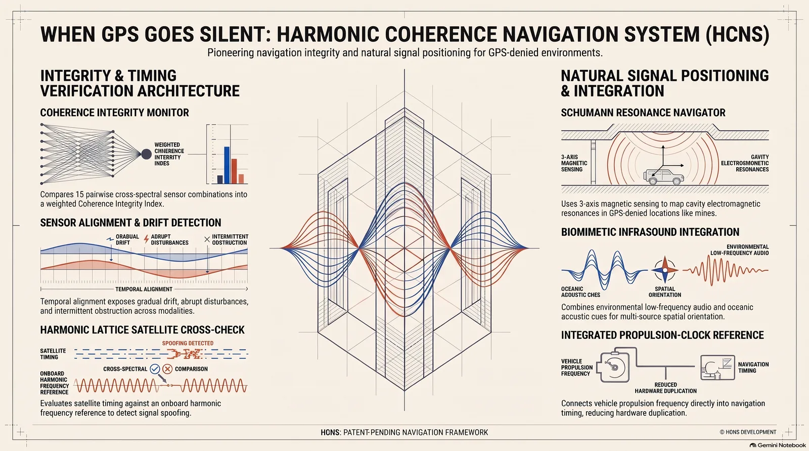
The architecture combines four layers that can be developed and tested separately, then evaluated together. At its center is a frequency reference framework:
f(N) = 700/N hertz
One member is 700/17, approximately 41.176 hertz.
The family provides a common structure for organizing measurements and examining their relationships. It does not supply a location by itself. Position must come from measurable differences between places; the reference framework helps organize the evidence.
1. Give navigation an independent integrity check
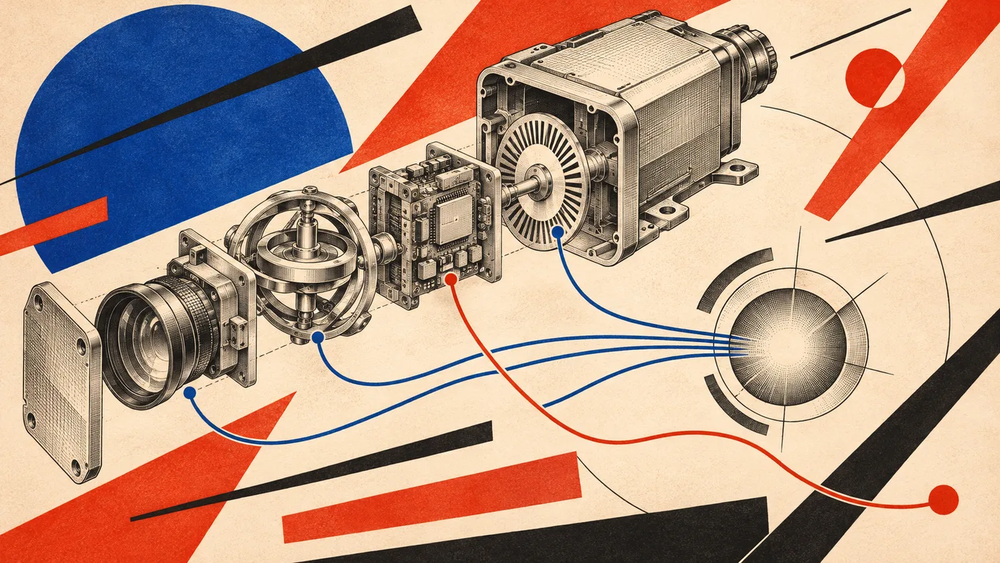
The Coherence Integrity Monitor runs alongside the primary navigation estimator.
The estimator calculates the vehicle’s best estimated position or motion. The monitor examines whether the measurements supporting that estimate remain consistent with one another.
Before comparing sensors, HCNS aligns their measurements in time and expresses them as estimates of a common quantity, such as speed or heading. Camera-derived motion and wheel measurements, for example, must describe the same physical variable before their relationship becomes meaningful.
With six sensor modalities, there are 15 pairwise comparisons. The design combines cross-spectral coherence measurements into a reliability-weighted geometric mean called the Coherence Integrity Index, while retaining diagnostics for individual sensors.
In practical terms, the monitor looks for changes in how the sensors agree over time.
Gradual deterioration may suggest drift. An abrupt change may indicate a failure or disturbance. Intermittent disagreement may point to an obstruction or unstable conditions.
Those distinctions could help a validated control system decide when to alert an operator, reduce speed, restrict autonomous operation or transition to a safer state.
Agreement alone cannot guarantee accuracy: several sensors can share an error, and coherent signals can still have the wrong scale or offset. The monitor therefore belongs alongside absolute-error checks and safety controls.
The engineering opportunity is to make deteriorating evidence visible before a plausible position estimate becomes a dangerous one.
2. Give satellite timing an independent reference
The Harmonic Lattice Positioning layer proposes a stable onboard timing reference against which satellite-derived time can be checked.
If the two diverge beyond the local clock’s measured drift and expected uncertainty, the discrepancy becomes a reason to investigate.
This adds another constraint for a counterfeit signal to satisfy. It must agree with trustworthy measurements already aboard the vehicle.
The practical protection depends on clock stability, initialization, isolation from untrusted inputs and detection logic. HCNS proposes integrating that timing cross-check with its harmonic reference framework and wider integrity monitoring.
3. Investigate the signals Earth already produces
The Schumann Resonance Navigator is the most exploratory part of HCNS—and the part that opens its most ambitious navigation question.
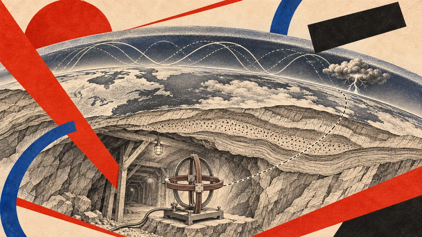
Lightning excites extremely low-frequency electromagnetic resonances in the cavity between Earth’s surface and its ionosphere. Researchers have measured these Schumann resonances inside the Kamioka mine, where the KAGRA gravitational-wave observatory operates.
Published measurements demonstrate that Schumann resonance signals can be detected in this underground environment. The measurements also reveal differences between magnetic-field amplitudes recorded inside and outside the tunnel, with variations depending on measurement direction.
That establishes a physical phenomenon worth investigating. It does not, by itself, establish a navigation method.
Could its measured pattern contain enough repeatable spatial information to help determine where a receiver is?
The proposed HCNS receiver uses three orthogonal magnetic sensing axes to measure patterns of amplitude and phase across multiple modes. Those measurements would be compared with a reference map collected at surveyed locations.
Think of it as investigating an environmental fingerprint: a combination of measured features that might help distinguish one place from another.
The central challenge is separating location from changing conditions. Lightning activity, the ionosphere, local machinery, receiver orientation and sensor noise can all affect the measurement. Different places may also produce patterns too similar to distinguish.
A useful navigator must demonstrate that it can recognize location across those changes.
If that can be established, natural-signal positioning could contribute an additional navigation reference in environments where satellite reception is constrained. Mines and tunnels are compelling places to begin. Underwater applications would require separate study of attenuation, conductivity and operating depth.
Detecting the signal is the starting point. Demonstrating useful location information is the milestone.
4. Bring multiple environmental cues together
The Biomimetic Frequency Orientation layer draws inspiration from biological navigation and its use of environmental cues.
The engineering principle is straightforward: combine several sources of information, assess how reliably they support one another, and keep conflicts visible.
This layer also considers environmental infrasound—low-frequency sound associated with sources such as ocean waves and infrastructure—as a candidate source of location-dependent information.
Each cue would have to earn its place through measurement. The goal is a navigation system that can make disciplined use of several imperfect sources of evidence.
A further possibility: the engine as part of the clock
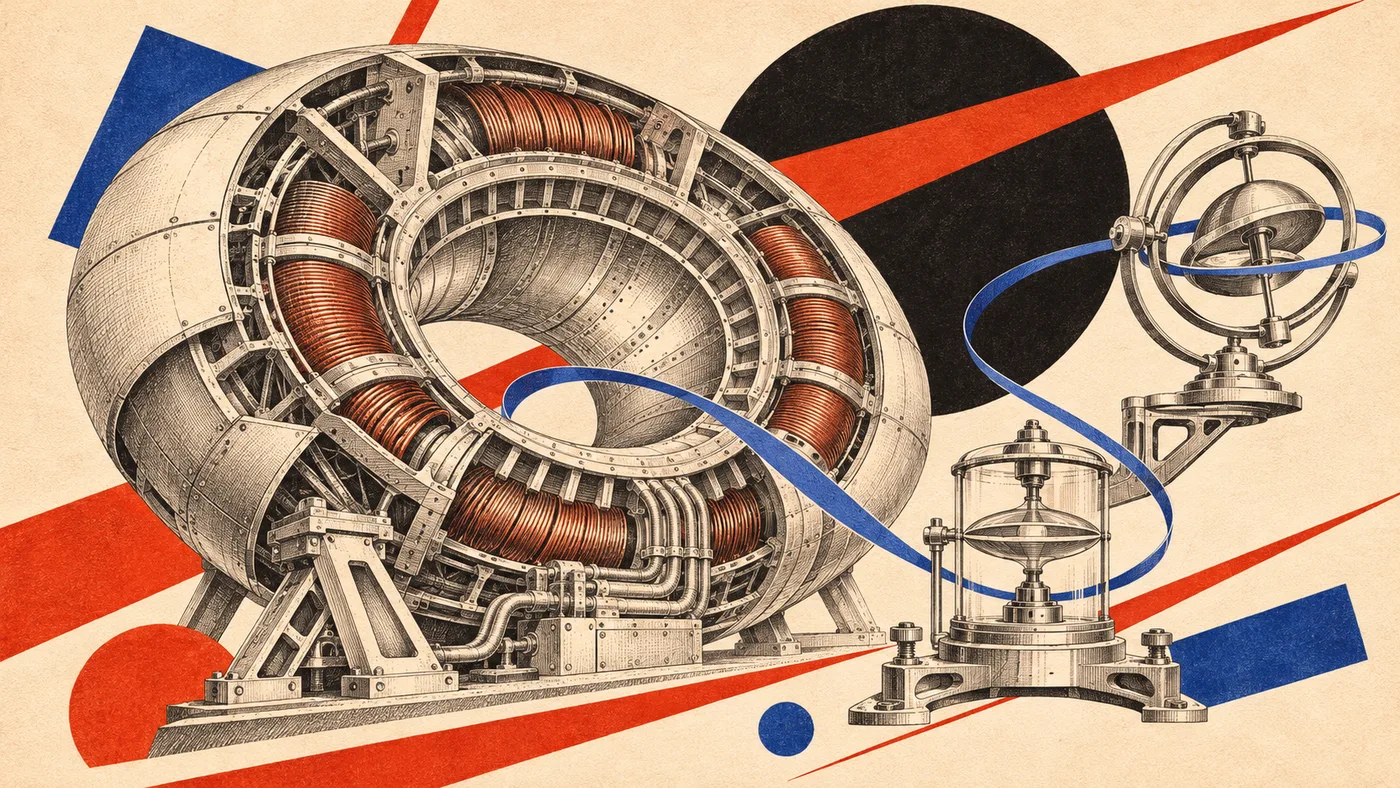
The same filing describes a longer-term integration with my proposed coherence engine.
The idea is that the propulsion system’s maintained oscillatory reference could also serve the navigation system’s timing architecture.
That would connect propulsion and navigation through a shared reference and could reduce duplicated hardware. It would require careful characterization under changing load, temperature and vibration, with safeguards against a propulsion disturbance becoming a navigation error.
It is an integration proposal with a clear engineering question to test: can that reference meet the stability and independence requirements navigation demands?
The next step is concrete
HCNS offers two development tracks that can move forward independently.
The integrity monitor can be evaluated using recorded sensor streams and controlled faults: drift, dropouts, timing errors, biased measurements and correlated failures. Its performance should be measured against existing integrity methods through missed faults, false alarms and detection latency.
The natural-signal navigator begins with receiver measurements at a surveyed underground site. The next stage requires multiple surveyed locations, repeated observations across different days, and blinded location tests using a fixed analysis method.
A simultaneous reference station would help separate changing global conditions from local differences.
The results that matter are position error, acquisition time, repeatability and the ability to decline a position fix when the evidence is insufficient.
These are separately testable engineering propositions. Neither requires the success of the other to produce useful findings.
This gives collaborators a practical route from architecture to measured performance.
I am seeking people and organizations with expertise in low-noise magnetometry, extremely-low-frequency measurement and navigation integrity, along with access to surveyed underground sites. I welcome conversations about experimental validation, development partnerships and licensing.
My role as an independent inventor is not to claim that these questions have already been answered. It is to propose the architecture, identify the measurable questions and pursue the collaborations necessary to determine what works.
For me, HCNS is another step in a sustained body of invention: applying the study of signal relationships to problems where reliability has real consequences.
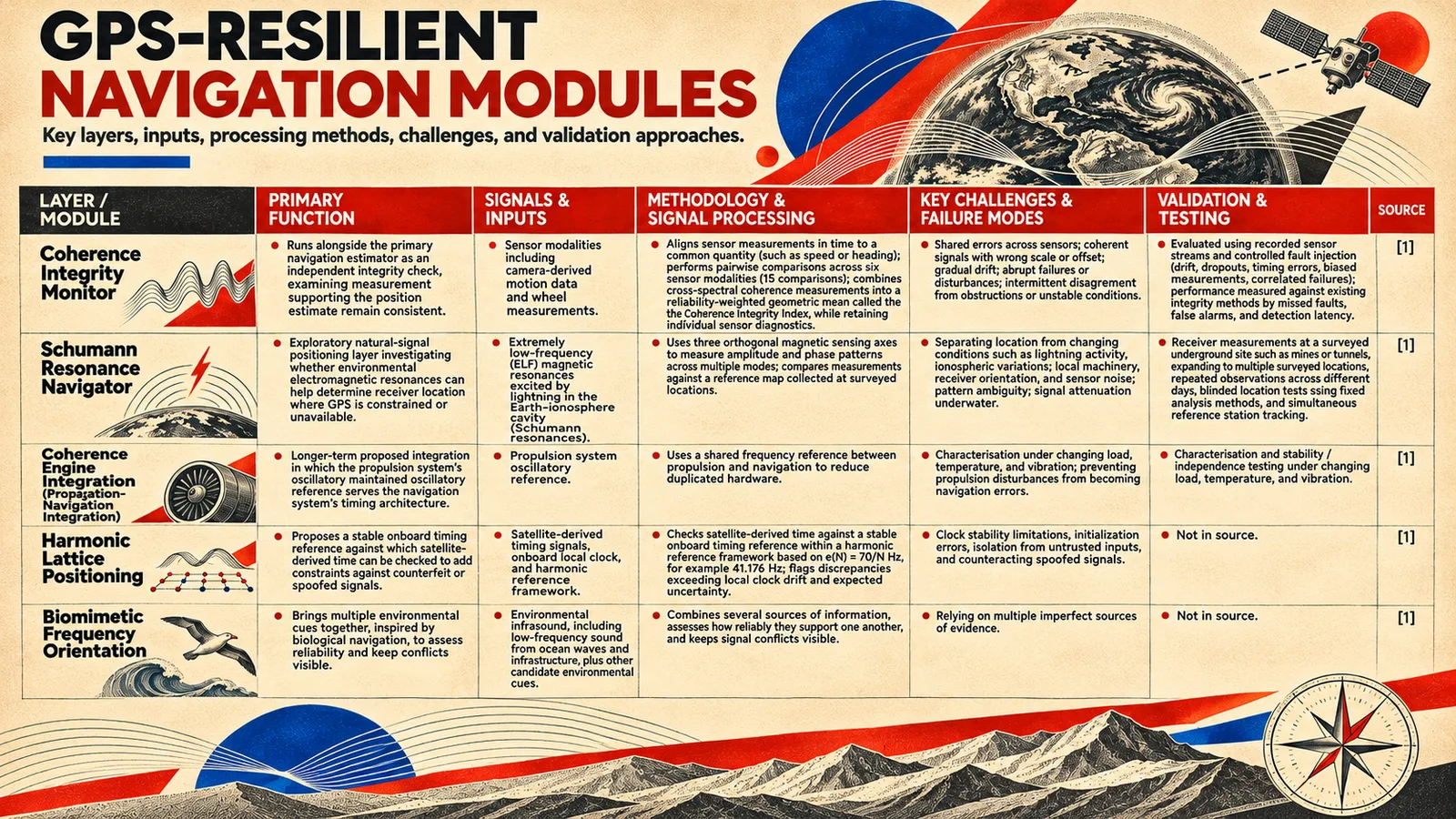
GPS transformed navigation by giving machines an extraordinary external reference. HCNS explores how we might strengthen that capability, provide additional references when it is unavailable, and help machines recognize when their evidence has become unreliable.
A navigation system should know more than where it thinks it is.
It should know when to doubt itself.
Paul Samuel Guarino
Independent Inventor
[email protected]
Scientific context: